OB298 — A Preliminary Atlas of Drone Strike Landscapes

A Dronestagram Family Portrait
It is difficult to describe a drone strike accurately.
On October 24, 2012, Bibi Mamana and her grandchildren were gathering firewood or picking okra outside their home. They may have been in a field. Perhaps it was a militant compound with a weapons depot. 2 missiles were fired, killing Mamana and up to 5 other people, injuring 6 to 8 of the children. Some other men, maybe 3, maybe militants, may have been caught in the blast. A house and a car may or may not have been destroyed. Either 3 cows or 1 buffalo and 2 goats were also killed. The drones remained overhead and 5 to 7 minutes after the first strike more missiles fell.
This moment—the drones, the missiles, the people, the livestock—is a node in a vast network. It spans the globe, connecting villages to secret installations to office parks to seats of government. It reaches backwards for millenia and will resonate forwards for untold centuries. To trace it out completely is impossible. We are hampered by its size and by the fact that much of it is hidden behind classified protections and some of the rest is barely recorded at all.
This is an attempt to understand the geography of a drone strike.
The Arena
Tappi—where the strike happened—is in Pakistan, near the Afghan border. It is sometimes spelled 'Tapi', sometimes called a village, and sometimes called an area. It is in North Waziristan, a mountainous region with a socially and religiously conservative culture. The rugged terrain makes it a difficult place to make a living and many locals emigrate to become labourers. When they can, they prefer a medical education.
After the fall of the Taliban government in Afganistan, insurgents began to move across the border and set up shop. In 2007, concerns over the Talibanization of the region led the National Security Council of Pakistan to hold a meeting to decide how to address the detriorating law and order situation. Their plan of action included the deployment of drones.
The region is marked by frequent blood feuds and Waziri religious leaders have been known to use outsiders—such as US forces hunting al-Qaeda fugitives—as a means of settling scores.
The Drone
The drones that killed Bibi Mamana were almost certainly US drones—MQ-1 Predators, flown by the CIA. They've been flying missions and hitting targets in Pakistan since 2004. The vast majority of the more than 360 strikes that have happened in Pakistan have been in North Waziristan.
The MQ-1 Predator was originally designed to be a high endurance surveillance platform, but later upgrades allowed it to carry a missile payload. A Predator can fly up to 740km, hold above a target for up to 14 hours, and still return to base. These high endurance times are perfect for the CIA, as it means they can keep a constant presence over an area, observing it for weeks.
Drones are not individual objects. They are distributed hyper-entities, smeared across the globe. A typical Predator system configuration might include four aircraft, one ground control system, a data distribution terminal, and a sattelite network to enable over-the-horizon control. The main piloting is often done from a remote location, but a ground crew is required in the field to maintain, launch, and land the aircraft.
The Runway
The drones fly out of covert airfields run by the CIA. The CIA is understandably reluctant to share the details of those locations, so some guesswork is required.

Until 2011, our best guess would have been here, the Shamsi airbase in Pakistan. In 2009, the Times of London published images taken from Google Earth's satellite view that showed what appeared to be 3 aircraft matching the profile of Predator drones. After the images came out, senior US officials confirmed that the base was used to launch drones, reversing several years of denial.
In December 2011, US forces were evicted from the base after NATO helicopters and airplanes killed 24 Pakistani soldiers stationed at 2 checkposts at Salala. Each side claims the other shot first. How much of a disruption the closing of Shamsi was to the CIA's operations is unclear. According to some reports and rumours, they had been winding down the use of the base anyway and the closure was more about placating the public. The Pakistan government walks a fine line with the CIA's activities. Publicly, it condemns the attacks though privately parts of the government are known to be sharing intelligence with the Americans.

These two sites represent two more candidate locations for the drones' origin. One is an airfield outside of Ghazi and the other is known as PAF Base Shahbaz, near Jacobabad. Both have been mentioned as likely CIA run drone airfields in Pakistan.
Jacobabad is named for Brigadier-General John Jacob. Jacob was an officer of the British East India Company. He fought in Afganistan before being put in charge of the frontier. He founded Jacobabad in 1847 on the site of Khangurh village and made it the seat of his administration. As an inventor, he developed an exploding shell with a range of 14 miles. His belief was that this would revolutionize war, allowing riflement to annihilate field artillery in short order.
Jacobabad is famous for its historical horse and cattle show. The show was begun by the occupying British Government as a way to obtain horses for its colonial cavalry.

The final candidate location is less likely, but more interesting. It is Camp Chapman, just outside of Khost in Afganistan, and just over the border from Tappi. Some reports indicate that drones may be housed there, though the security situation makes it unlikely. It is too exposed.
Chapman is named for the first US serviceman to die in Afghanistan after the US invasion. Nathan Chapman was killed in action nearby on January 4, 2002. The base began life as a military facility before being turned over to the CIA. Nearby FOB Salerno is the US military facility colloquially known as 'rocket city' because of the frequency of attacks by insurgents.
Because it is just over the border from Pakistan, Camp Chapman is thought to have evolved into a key counterterrorism site and a hub for the CIA's Special Activities Division, the part of the CIA responsible for running the drone operations. It's unlikely that drones are directly operating out of Chapman, but the intelligence gathering and processing that leads to strikes is almost certainly happening here.
Chapman is best known as the site of the suicide bombing that claimed the lives of 7 CIA operatives in 2009, an incident fictionalized in Zero Dark Thirty. Because it is so close to the border and to North Waziristan, Camp Chapman is a natural place for informants to meet with CIA operatives. It may have been that loosened security regulations—intended to put informants at their ease—allowed the suicide bomber to get so close.
In the week after that attack, the CIA conducted 5 drone strikes in North Waziristan. This is an unusually high number. On average, drones hit Pakistan every 5 days.
The Aircraft
The MQ-1 Predator is designed and manufactured by General Atomics.

General Atomics is headquartered in San Diego, California. It began as a division of General Dynamics with a charter to explore peaceful uses of atomic energy. Its mission has since expanded.
San Diego is the eighth largest city in the US. It is a Navy town, housing the largest naval fleet in the world. The military is deeply wrapped up in San Diego's economy, with General Atomics being one of several major military contractors that began operations and remain headquartered there.

The Predator drones are probably built here, in a factory about 25 miles northeast of General Atomics' HQ, in Poway California. It takes 23 weeks to build a Predator. The bulk of the airframe is made of a composite of black carbon-fiber and graphite fabrics impregnated with epoxy resin.
A computer-driven cutting machine cuts the fabric into parts. Guided by lasers, workers layer these parts together in molds. By carefully arranging the layers so that their weaknesses cancel out, and using spacers that provide volume and strength without much weight, the final composite pieces are very strong, and very light. Once laid out, the parts are cured in an oven and allowed to set. Workers and robots do the final trimming.
The factory covers 3 acres. The main assembly floor is open concept with labelled areas describing the work happening at each place. Wing assembly here, fuselage assembly there. The assembled parts are painted in a different building and then moved to the integration floor, where the engine, electronics, and avionics are added.
The Components

The engine that powers the Predator is built here, in Gunskirchen, Austria by BRP-Powertrain GmbH & Co KG, better known as Rotax. Gunskirchen is tragically best known for being the location of a concentration camp during WWII.
Founded in 1920, Rotax historically built 2 stroke engines for snowmobiles, motocycles, and other small land vehicles. In 1982 they moved into 4 stroke engines for (amongst other things) aircraft.

The Predator's Lynx radar comes from closer to home. It was designed and built by Sandia National Laboratories under the direction of General Atomics. Sandia is a wholly owned subsidiary of Lockheed Martin Corporation. Sandia's primary headquarters are here, in Albuquerque, New Mexico on Kirtland Air Force Base. 8,700 people are employed there.
Sandia's roots are in the Manhattan Project. The scope of their contemporary research efforts is breathtaking, ranging from body armour to biotechnology. The Lynx radar is designed to require minimal radar knowledge on the part of the operator. Instead, the user interface allows pilots to treat it as much like an optical sensor as possible.

The optical and infrared sensors on the Predator are built by Raytheon SAS, who are headquartered here, in El Segundo, California. The system is called the MTS-A for multi-spectal targetting system. The sensors are mounted on a turret, and beyond the obvious surveillance aspects, they provide laser guidance for the missiles the drones fire.

Pinning down the source of the carbon fiber that makes up the airframe of the Predator turns out to be very difficult. Unlike most of the rest of the vehicle, no manufacturers are proudly proclaiming their role.
The indictment of Ming Suan Zhang in a plot to smuggle carbon fiber to China may offer a clue. Undercover agents were approached by unknown parties to purchase Toray type M60JB-3000-50B carbon fiber, and Zhang is accused of planning to illegally export tonnes of the stuff to use in the construction of a Chinese fighter jet.
Toray Carbon Fibers America is a subsidiary of Toray Industries, Inc. of Japan. Its carbon fiber manufacturing facility is here, in Decatur, Alabama. According to the company, it's the world's largest single carbon fiber production line. It was upgraded to produce 3,600 tonnes per year in 2006. Toray type M60JB-3000-50B is a high grade material that costs $2,200 per kilogram. It is used primarily in military and aerospace applications. It seems possible that it's used to build Predators.
The Testing Facility
Completed Predators immediately have their wings removed, so they can be crated and shipped for testing in the Mojave Desert, near Palmdale California.

Our most likely candidate for a testing location is El Mirage airfield. El Mirage is the facility where much of General Atomics' testing occurs. In August 2012, a pair of drones collided on its runway.
Palmdale calls itself the aerospace capital of the US, though in an effort to reduce the community's reliance on the feast or famine business cycles of that industry and to reduce traffic congestion from people working over the mountains in LA, the city has authorized special economic zones designed to encourage new companies to set up in the area.
General Atomics are currently hiring for positions such as INTEGRATION TECHNICIAN I and AVIONICS TECHNICIAN II in Palmdale. Security clearance is required.

Another possibility is Gray Butte Field, also near Palmdale. The field is a relatively recent purchase by General Atomics Aeronautical Systems. The FAA warns: "UNMANNED ACFT OPNS ON AND INVOF AIRPORT"
The Command Station

Almost nothing is known about the the CIA agents who operate the drones that fly over Pakistan. The CIA drones are operated by an office called the Pakistan-Afghanistan Department, which operates under the CIA's Counterterrorism Center (CTC). They are thought to pilot them from the basement of the CIA's headquarters in Virginia, pictured here.
More is known about the conditions under which their compatriots in the Army and Airforce work. Their bases are spread over the world, most famously in Nevada. The command stations are essentially airconditioned trailers with several screens connected to joysticks, targeting systems, a mouse and a keyboard. Two people work in tandem to fly the drone—a pilot and a payload operator. They use a mixture of radio and instant messenger clients to connect with spy plane pilots, field commanders, headquarters, and troops in combat (presumably, the CIA pilots don't have to worry about that last group). Information overload is said to be a significant problem, leading to exhaustion and pilot error.
Many commentators have compared the command stations to videogame platforms and have worried that this disconnects the pilots from combat and dehumanizes their targets. Many drone operators say it's the opposite. Because they often surveil a target for days or weeks during operations, they develop a strange intimate relationship with those they kill. They watch targets eat with their families, sleep with their partners, and go about their daily lives. Then they watch them die.
The transition from being at war as a day job and moving seamlessly into civilian home life is said to be incredibly jarring. Unlike soldiers in the field for whom war is the current normal, drone operators are expected to navigate between bombing suspected terrorists and picking the kids up from soccer practice over the course of an afternoon. This represents a significant context shift.
War is no longer physically located in a single space. There is no front if on one side combat pilots mingle with their civilian neighbours after hours and on the other side explosive ordinance may fall from the sky anywhere at any time, launched by nothing at which to return fire.
The Missile
The missile that killed Bibi Mamana was almost certainly a HELLFIRE II (marketing material always renders the name in caps). HELLFIRE II can be launched from ground, sea, and air. It is the primary air to ground missile used by the US, carried by helicopters and drones.

The HELLFIRE II is manufactured by Hellfire Systems LLC, a joint venture of Lockheed Martin and Boeing. It is manufactured at a facility in Orlando, Florida.
The missiles were probably AGM-114K-A, AGM-114N, or AGM-114P variants. The K-A has a fragmentation sleeve, for use on unarmoured targets in the open. The N uses a thermobaric warhead. These can suck the air out of a cave, collapse a building, or produce an astoundingly large blast radius in the open, making them devastatingly useful in Pakistan.
The AGM-114P is a more recent addition and was specifically created for a drone flying at altitude. It is a missile reinvented for a particular kind of combat, one which happens vertically, through layers of air. Because of the significant differences in temperature between where the missile is launched and where it lands, it is to be built for greater environmental tolerances than its siblings. The variant also gains the ability to target in 360 degrees, an concession to the inability of drones to swivel and point, unlike their helicopter counterparts.

The AGM-114P variant was successfully tested here, at Naval Air Weapons Station, China Lake, California, in 2010. Assistance was provided by General Atomics' El Mirage Flight Test Facility. The test paved the way for full product of the UAV specific variant.
HELLFIRE has a long history. It first entered service in 1985, primarily as a weapons for helicopters. The first shots fired during Operation Desert Storm were by Apache helicopters using HELLFIRE missiles and HYDRA-70 rockets to destroy 2 Iraqi radar facilities. Today, the HELLFIRE contract is worth billions. In 2008, Lockheed Martin announced that US forces had passed 6,800 HELLFIRE II launches in Iraq and Afghanistan.
The Command Structure
The decision to launch any particular drone strike comes from CIA HQ in Langley. Under the Obama administration, responsibility for authorizing a strike falls solely on the director of the CIA, or his deputy in the event that the director is unavailable. At the time that Bibi Mamana was killed, David Petraeus was director of the CIA.
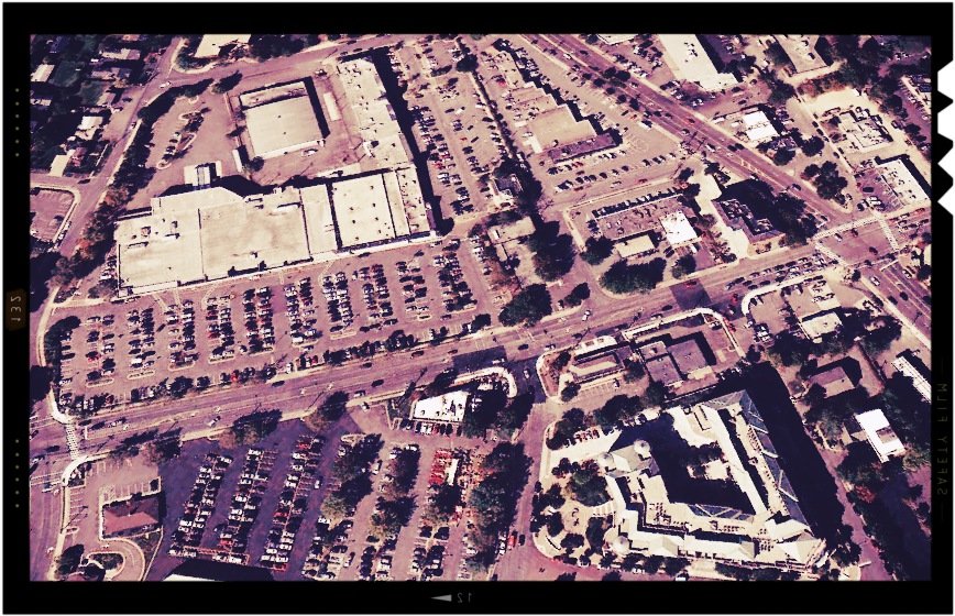
David Petraeus lives near here, in MacLean Virginia. His actual address is an 'undisclosed location' but he shops at the Verizon store in this shopping centre.
Like his predecessors, Petraeus used 'signature' strikes to select and destroy targets. Unlike 'personality' strikes, where the target is a positively identified terrorist leader or some other high value individual, signature strikes involve looking for behaviour patterns to identify groups of men who appear to be behaving like terrorists, whether or not their identities are definitively known.
One of the claimed benefits of this approach is that it makes militants more reluctant to congregate, for fear of being droned, which in turn makes it harder for them to train, or plot against the United States. This is a remarkable approach to counter-insurgency. It's an attempt to identify and control the enemy in a frontless war by making targetting determinations based solely on how people move through the landscape. Invisible panoptical sky gods rain HELLFIRE down upon the possibly guilty, to scare the rest into submission. Dominance through terror.

Ultimate responsibility for the drone program resides here, in the White House, residence and offices of the American President who was Barack Obama at the time of the strike.
One disadvantage of the signature strike policy is that, from a drone, it is difficult to tell the difference between a meeting of militants and a meeting of civilians, as the President learned 3 days after his innauguration in 2009 when a drone strike killed a prominent elder and members of a pro-government peace committee in Karez Kot, Afghanistan.
Despite these missteps, Obama has chosen to step up the drone program, conducting more strikes in his first year than the previous administration's entire 8 year term in office. The strike that killed Bibi Mamana was the 298th strike conducted on Obama's watch.
The Livestock
The livestock that were killed (either 3 cows or 1 buffalo and 2 goats) were meant to be sacrificed 2 days later for Eid al-Adha, a festival that celebrates Ibrahim (Abraham in English)'s willingness to sacrifice his son Ishmael on God's command. In the story, God intervenes, replacing Ishmael with a lamb.

Islamic tradition holds that the events leading to the sacrifice happened here, at Mecca about 4,000 years ago. Mecca became the heart of Muslim worship in 630 when Muhammed and his followers completed a nearly bloodless conquest of the city. Islam reached what is now Pakistan in 711.
Every year, Muslims performing the Hajj make their pilgrimage here and spend a week performing a series of rituals symbolic of the lives of Ibrahim and his wife Hajar. The Hajj culminates with Eid al-Adha.
Eid al-Adha is also celebrated for 4 days all around the world. It is a time of great charity. Sacrificed animals are divided into 3 parts. 1 third goes to the family, 1 to neighbours and friends, and 1 to the poor and those in need.
The Family
Little is recorded about what happened to the family after the missiles fell.

After the attack, the family travelled here, to Islamabad for medical treatment. 8 year old Nabeela ur Rahman, who watched her grandmother explode, was healing well from the shrapnel. Her brother, Kalim ur Rahman, who had run out of the house and was hit by the second round of missiles, underwent surgery for an infected broken leg.

In December, one of Mamana's sons, Ishqur Rahman, joined a protest outside the Press Club here in Miranshah. The protest was to demand that relatives of drone strike victims be considered for compensation alongside families of the civilian casualties of Pakistan Army operations. At present, they are not.
Bibi Mamana was mourned in a closed coffin funeral.
At the time of the strike, she was 65.
Or perhaps 67.
Images
First image: Site of the strike from James Bridle's Dronestagram project. All the rest are taken from Google Maps satellite view or Google Earth's satellite view and then manipulated with various hipster/Instagram-type photo editing suites. They are my best guesses at the locations being discussed.
Sources
- Site of the strike from Dronestagram
- A collection of information about strike OB298 (scroll down)
- Wikipedia's entry on North Waziristan
- An overview of the Predator MQ-1
- The drones in Shamsi airbase were found using Google Earth
- The 2011 firefight between NATO and Pakistan
- Wikimapia's entry for the Salala Check Post
- Wired on the extent of the CIA's drone base network
- Where back up bases might be after Pakistan evicts the US from Shamsi
- Wikipedia's entry on the Ghazi-Barotha Hydropower Project
- Wikipedia's entry on General John Jacob
- One of several reports suggesting that Salerno could be a back-up drone base
- Information from the Afghan Ministry of Transport and Civil Aviation about Khost/Chapman
- A memorial site for Camp Chapman namesake, Nathan Chapman
- Wikipedia's entry on the CIA SAD
- Wikipedia's entry on The Camp Chapman attack
- The Washington Post suggests that Camp Chapman had lower security on purpose
- Wikipedia's entry on the Predator Drone
- How Stuff Works on the internals of the Predator
- The corporate about page for General Atomics
- Wikipedia's entry on San Diego
- An article about the impact of drones on San Diego's economy
- Code Pink's Fact Sheet about drones
- Home page of General Atomics Aeronautical Systems, Inc.
- The Airforce Times describes the making of a drone
- FAA information about Gray Butte Field Airport
- The Center for Land Use Interpretation's infosheet for El Mirage Flight Test Facility
- The story of the drone collision at El Mirage
- Wikipedia's entry for Palmdale
- Wikipedia's entry on Gunskirchen
- A paper outlining the development of the Lynx radar (PDF)
- Sandia's official visitor information page for their Albequrque New Mexico location
- Raytheon's press release announcing the contract to build MTS
- Raytheon's Multi-Spectral Targeting System product page
- The plot to smuggle carbon fiber
- The official home page of Toray Carbon Fibers of America
- Lockheed Martin's Hellfire product page
- Boeing's Hellfire product page
- Lockheed Martin's official page for the Orlando facility
- A detailed recent history of Hellfire missile contracts
- Some brackground information about Hellfire orders
- The CIA using smaller missiles
- Lockheed Martin's Scorpion Missile Fact Sheet
- Reports that there were multiple drones
- Der Speigel on the life of a drone pilot
- The New York Times on the life of a drone pilot
- CBS news on the network of the drone bases
- An encounter with David Petraeus near a shopping centre
- An excerpt from a book about Obama's war on terror
- An explanation of signature vs targetted strikes
- An overview of American drone strike statistics
- Wikipedia on Eid al-Adha
- Wikipedia on the Hajj
- Pakistan Today mentions the December 2012 protest by Ishqur Rehman
- The Times of London visits the family
- The BBC visits the family
- Full video of the BBC report
Festival & Funding
This is part of the Murmuration Festival of Drone Culture. The organizers are making a physical document of the whole proceedings. Click here to contribute to the Kickstarter.